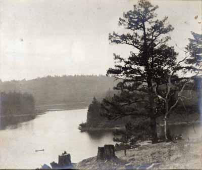
The Photo in Question (click on image for a larger version)
Weston Lake
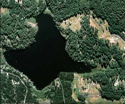
Cusheon Lake
Goole Map image

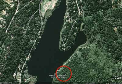
Marshall Sharp photo Cusheon Lake
The Photo in Question (click on image for a larger version) |
Weston Lake |
Cusheon Lake Goole Map image
|
Marshall Sharp photo Cusheon Lake |
With the property being so high and the islands in such close
proximity to land, I think it has to be a property on or just off Beddis
Road (including Rourke), looking out to the islands in the harbour. That's
my best guess and I have kayaked most of the waters around Salt Spring.
Cheers, Maggie
I wondered about Weston Lake - maybe from Valdy's place or his sister's.
Barb
One possible location might be Cusheon Lake. Click on the image.
I understand the choice of Cusheon because of its wiggly in-and-out outline.
But I'm not sure it would be Cusheon, because of the scale of the trees - they become way too small on the furthest side.
I'm used to looking out across Cusheon from high up, and the trees on the furthest shore in life more resemble the scale of the trees on the left-hand across-the-water shore in the photo.
Also, the points of land at right and at left seem too close together to be Cushepn's point.
However, from the red-circled vantage-point proposed, I've only ever viewed the scene at water level - literally, swimming. And without contact lenses, because they had a tendency to float out in water!
So the evidence of my eyes cannot be trusted in this case.
Is that a canoe in the water on the left? If so, it might give us an idea of the scale at that point.
The viewpoint of this photo is from higher land than the shore?
At first glance the land-edge looks to me like cliff-edge rather than water's edge, so that the big dark tree's rooted trunk is likely to be lower down, out of sight?
I think Maggie Allison might be right - that these are islands, not lakeshore land ...
The canoe is probably a log or debris.
There are also logs on the beach in the little inlet
Frank
 |
 |
![]()